39 miles of shoreline, beach villages, and the state’s main airport at your door.
By Junia Janvier, REALTOR® · Corcoran Chart House Realty · Updated October 2026
Warwick is Rhode Island’s third-largest city, a coastal city of villages wrapped around Greenwich Bay. This guide covers its history, its villages, what homes cost to buy and carry under Warwick’s own tax rate, how residents get around, and what buyers should check before making an offer, from flood zones to flight paths.
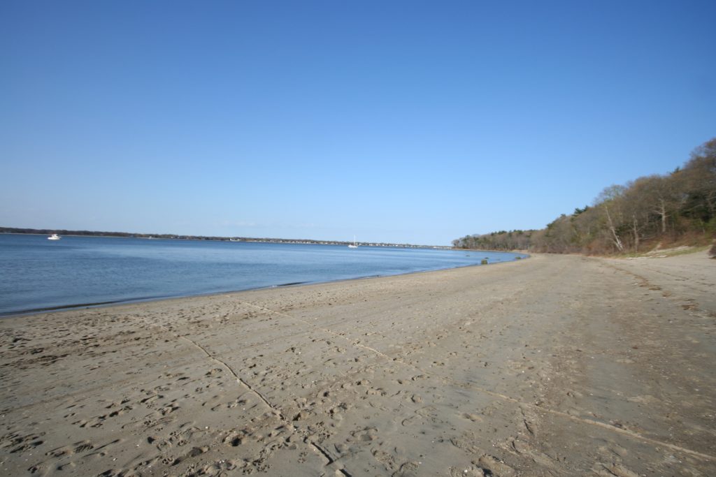
Warwick sits south of Cranston along the west shore of Narragansett Bay, with 39 miles of shoreline on the Providence River, Greenwich Bay, and the bay itself. Samuel Gorton settled the area in 1642 after buying the Shawomet Purchase from the Narragansett sachem Miantonomi, and the town was incorporated in 1647.
Warwick was devastated during King Philip’s War in the 1670s and rebuilt slowly as a farming and coastal community. In 1772, local patriots seized and burned the British revenue schooner Gaspee off Gaspee Point, one of the first acts of open resistance before the American Revolution. In the 1800s, villages such as Apponaug and Pawtuxet grew around mills, harbors, and crossroads.
The shore became a destination. Rocky Point drew crowds from the 1840s onward and grew into one of New England’s best-known amusement parks, with rides and a shore dinner hall that seated 4,000. Warwick became a city in 1931, and its population more than doubled between 1940 and 1960 as suburban neighborhoods filled in.
Rocky Point closed in the mid-1990s, and after years of effort the land was preserved and reopened as Rocky Point State Park in 2014. Today Warwick, with about 82,800 residents in the 2020 Census, blends beach villages, suburban neighborhoods, and the state’s main airport.
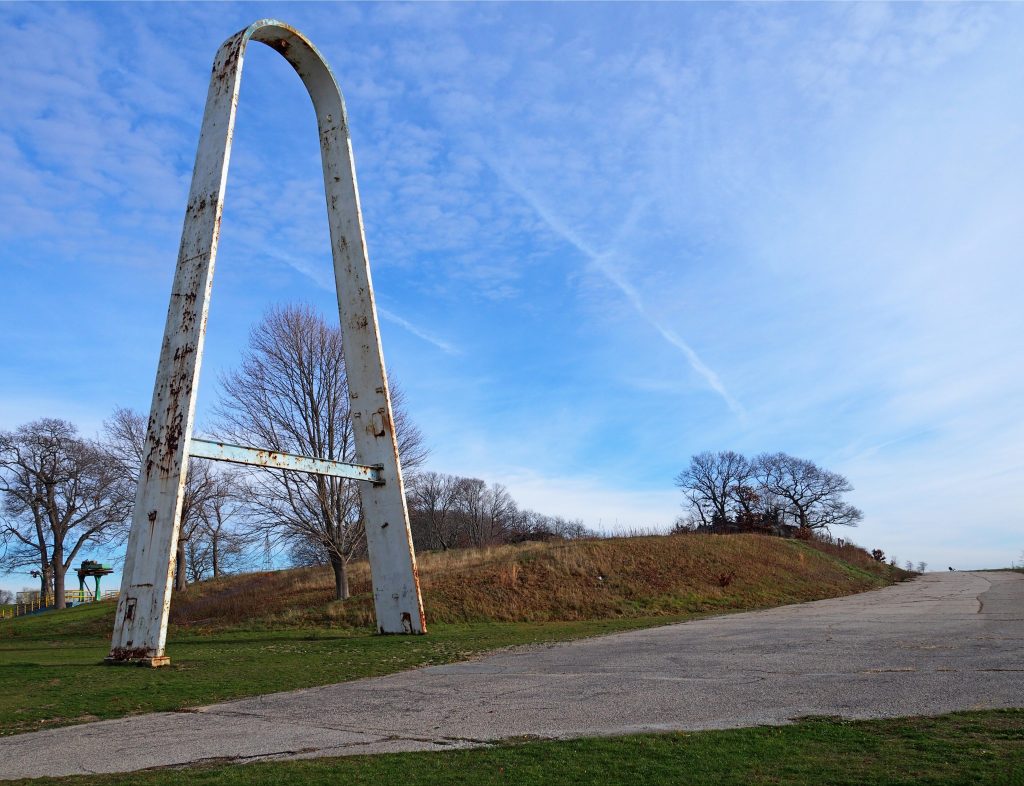
Rocky Point State Park
Getting oriented
Villages and sections
Warwick is a city of villages, and each one has its own setting, from bay beaches to inland suburbs.
Apponaug and the center
A historic village near the Route 117 rotaries and the heart of city government, surrounded by suburban neighborhoods and close to I-95 and I-295.
Conimicut, Oakland Beach, and Warwick Neck
Shore villages along the Providence River and Greenwich Bay with beaches, cottages, and year-round homes. Rocky Point State Park is on Warwick Neck.
Gaspee Point and Pawtuxet
The northern edge of the city near the Cranston line, including Warwick’s side of historic Pawtuxet Village and the site of the Gaspee Affair.
Cowesett and Potowomut
Southern sections near Greenwich Bay. Potowomut is geographically separated from the rest of the city and is home to Goddard Memorial State Park.
Housing
Homes and architecture
Much of Warwick’s housing dates from the mid-20th century suburban boom, with older homes in its historic villages and along the shore. Expect capes, ranches, and colonials on suburban streets, waterfront cottages and year-round homes in the beach villages, and a range of condos.
Capes and ranches: the classic Warwick home, often on lots with yards and driveways
Colonials and newer homes: larger houses in sections like Cowesett and Warwick Neck
Waterfront cottages: seasonal-style homes in shore villages, many converted to year-round living
Condos: a common entry point, from garden-style complexes to waterfront buildings
Goddard Memorial State Park
Market deep dive
The market and what homes cost to carry
Warwick is one of the busiest markets in Rhode Island. In September 2026 the median sale price was around $435,000, homes typically sold in about 27 days, and 338 homes sold that month. Shoreline homes carry different insurance and flood considerations than inland homes at the same price.
Property taxes, worked out
Warwick sets its own tax rate, separate from Providence. Here is what the FY2026 residential rate looks like at Warwick price points.
Home value
Rate per $1,000
Yearly tax
Monthly
$350,000
$12.70
$4,445
~$370
$440,000 (around the median)
$12.70
$5,588
~$466
$550,000
$12.70
$6,985
~$582
Assessed values often differ from sale prices, and exemptions such as homestead or senior exemptions can change the bill. Rate: Rhode Island Division of Municipal Finance, FY2026 tax rates.
For waterfront and low-lying homes, flood insurance can add as much to the monthly cost as taxes do. Get an insurance quote early so you can compare inland and shoreline homes on the full monthly payment.
Commute & transit
Getting around
On foot: the beach villages and Pawtuxet are the most walkable parts of the city
By bus: RIPTA routes serve Warwick and connect to Providence
By train: the MBTA commuter rail station at T. F. Green Airport offers weekday service to Providence and Boston’s South Station
By car: I-95, I-295, Route 37, and Route 117 cross the city, and downtown Providence is about 15 to 20 minutes north
By air: Rhode Island T. F. Green International Airport is in Warwick, minutes from most neighborhoods
Outdoors
Beaches, parks, and the bay
Goddard Memorial State Park: about 490 acres on Greenwich Bay with a swimming beach, a nine-hole golf course, 18 miles of bridle trails, picnic areas, and a performing arts center
Rocky Point State Park: about 120 acres of shoreline trails and lawns, with the park’s landmark arch and a public fishing pier
Oakland Beach and Conimicut Point: beaches, sunsets, and views of the bay
Boating: Greenwich Bay and its coves are central to life in the shore villages
Lifestyle
Daily life in Warwick
Warwick blends beach-town living with suburban convenience. Summer evenings might mean a walk at Rocky Point or sunset at Oakland Beach, errands happen along the city’s major retail corridors, and the airport makes weekend trips easy.
June: Gaspee Days in Pawtuxet Village, shared with Cranston, with a parade and a reenactment of the burning of the Gaspee
Summer: movies on the lawn and other events at Rocky Point State Park
Summer: beach days, picnics, and trail rides at Goddard Memorial State Park
For schools, public schools are run by Warwick Public Schools, which operates two comprehensive high schools, Toll Gate and Pilgrim; families can review school data through the Rhode Island Department of Education.
Honest take
Pros and tradeoffs
What people love
Beaches, parks, and the bay close to home
The airport and commuter rail right in the city
A lower residential tax rate than many nearby cities
Yards and driveways at accessible prices
What to weigh
Waterfront homes carry higher flood and insurance costs
Airport flight paths affect noise in some neighborhoods
Most errands and commutes require a car
Summer traffic near the beaches and parks
Buyer checklist
What to check before you buy in Warwick
Flood zone: look up the property on FEMA’s flood maps and get an insurance quote early for anything near the water
Total monthly cost: Warwick sets its own tax rate, so compare taxes, insurance, and payment against Providence options
Airport noise: visit at different times of day and check flight paths for homes near T. F. Green
Waterfront rules: confirm what coastal regulations mean for additions, docks, and renovations
Older homes and cottages: budget for inspections of foundations, heating, and systems in converted seasonal homes
Be ready: get pre-approved early, since well-priced homes move quickly
FAQ
Questions buyers ask about Warwick
What is Warwick’s property tax rate?
The FY2026 residential rate is $12.70 per $1,000 of assessed value. A home assessed at $440,000 would pay about $5,588 a year before exemptions.
What does a home in Warwick cost?
In September 2026 the median sale price was around $435,000, and homes typically sold in about 27 days. Waterfront homes usually cost more.
Can you commute from Warwick to Boston by train?
Yes. The MBTA commuter rail station at T. F. Green Airport offers weekday service to Providence and Boston’s South Station.
Is Warwick in a flood zone?
Parts of it are, especially low-lying blocks in the shore villages. Check each property on FEMA’s flood maps and get an insurance quote before making an offer.
Work with Junia
Thinking about Warwick?
Junia Janvier is a REALTOR® with Corcoran Chart House Realty who helps buyers and sellers across Rhode Island, in English and Haitian Creole. Bring your budget, your timeline, and your questions, and she will help you see where Warwick fits.
Sources: Redfin city data, September 2026; Rhode Island Division of Municipal Finance, FY2026 tax rates; 2020 U.S. Census; City of Warwick; Wikipedia articles on Warwick, Rocky Point State Park, Goddard Memorial State Park, and Pawtuxet Village. Figures change often and are provided for general information only; contact Junia for current numbers. Photos: Greenwich Bay by PumaGator (CC BY-SA 4.0); Rocky Point by Rhododendrites (CC BY-SA 4.0); Goddard Memorial State Park by Joe Bar (CC BY 2.0), via Wikimedia Commons.
Junia Janvier, REALTOR® | Corcoran Chart House Realty | 47 Maple Avenue, Barrington, RI 02806 | (401) 246-4198 | RI License RES.0201111. Corcoran and the Corcoran logos are trademarks of Corcoran Group LLC. The Corcoran® System is comprised of company owned offices which are owned by a subsidiary of Anywhere Real Estate Inc. and franchised offices which are independently owned and operated. The Corcoran System fully supports the principles of the Fair Housing Act and the Equal Opportunity Act.
Equal Housing Opportunity
Top
Stay in the Loop
Get insights, resources & ideas delivered straight to your inbox. No spam, ever.

 Equal Housing Opportunity