Rhode Island’s second-largest city, from historic Edgewood and Pawtuxet to open space in the west.
By Junia Janvier, REALTOR® · Corcoran Chart House Realty · Updated October 2026
Cranston stretches from the Providence River to semirural land beyond I-295, and its neighborhoods vary as much as any city in the state. This guide covers Cranston’s history, its villages, what homes cost to buy and carry under its own tax rate, how residents get around, and what buyers should check before making an offer.
Cranston borders Providence to the south and west and runs from the Providence River to the rolling land of western Rhode Island. It was created as a town in 1754 and became a city on March 10, 1910. Historians still debate whether the name honors Governor Samuel Cranston or his grandson Thomas.
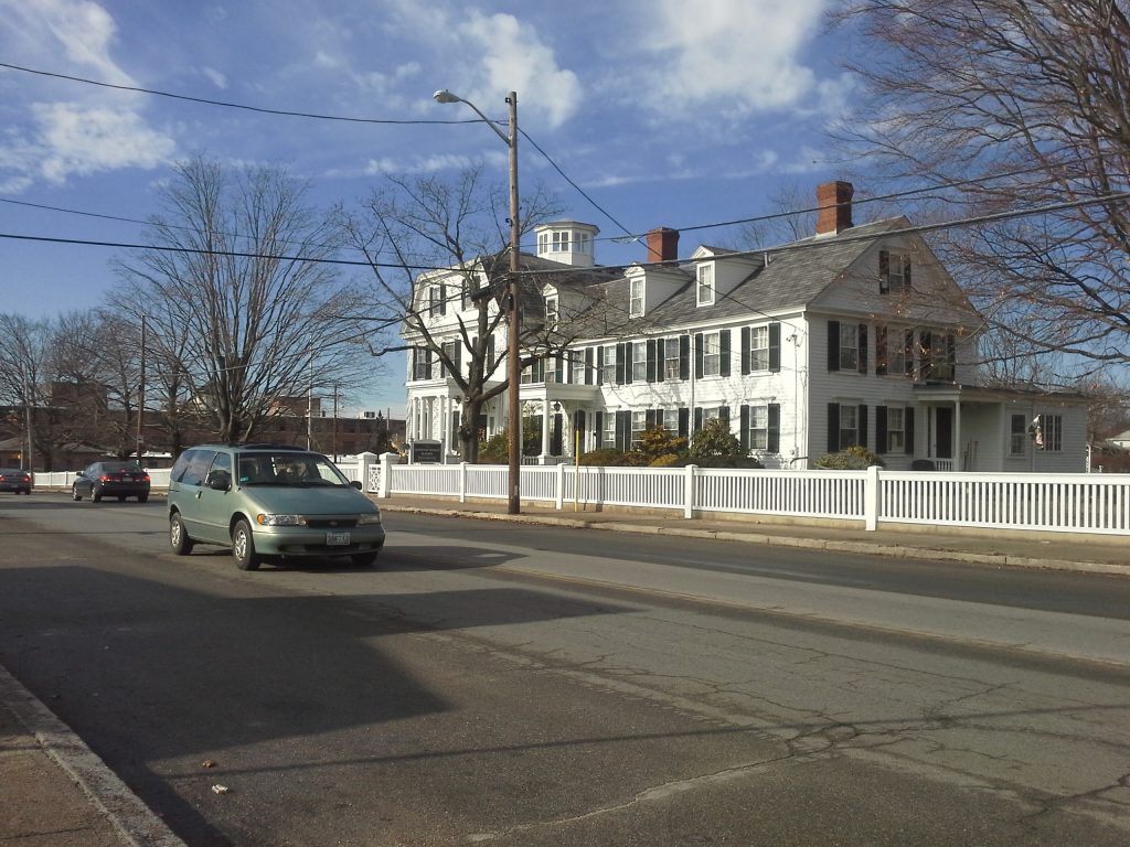
Its oldest village is Pawtuxet, where the Pawtuxet River meets the bay. Roger Williams bought the land in 1638 from the Narragansett, and the village later became a port and then a mill center. In 1772, Rhode Island patriots from the area burned the British revenue schooner Gaspee, an early act of resistance before the American Revolution.
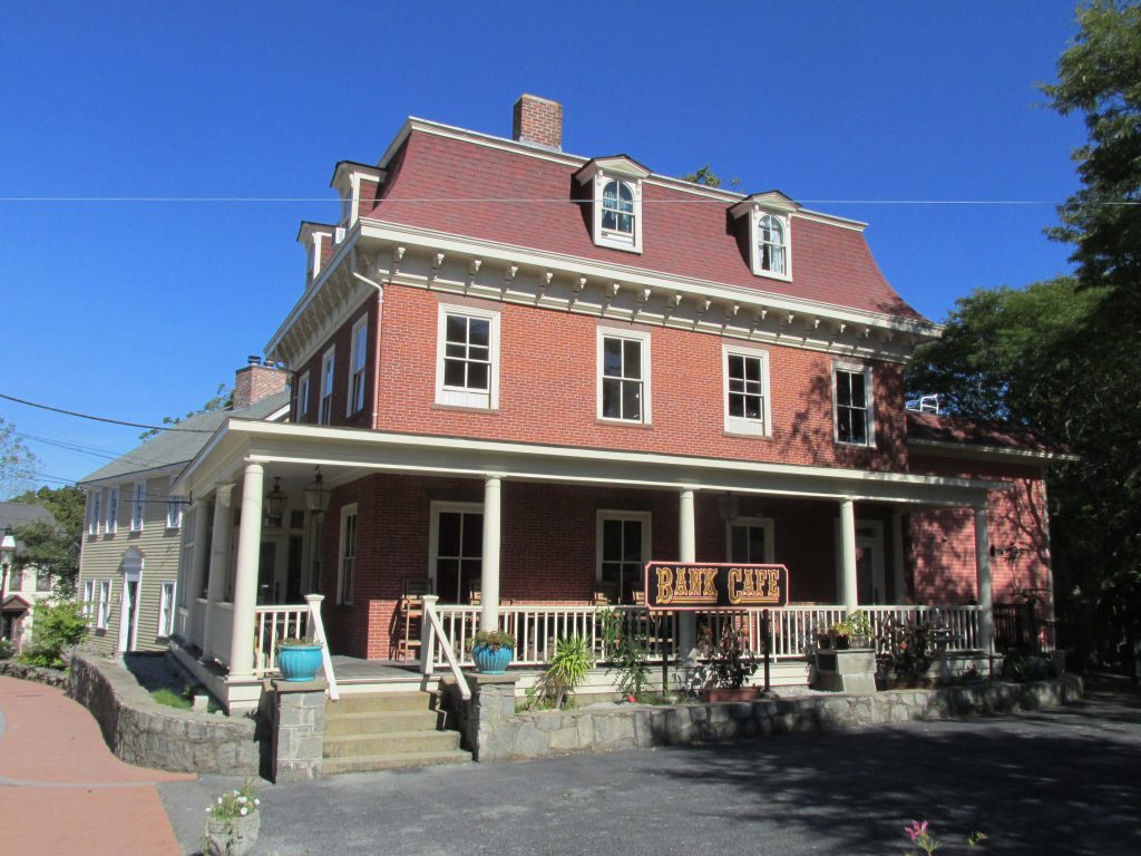
Industry grew in the 1800s. The Sprague family founded the Sprague Print Works in 1808, which became the Cranston Print Works, and their homestead, the Governor William Sprague Mansion on Cranston Street, still stands. In the early 1900s many immigrants from Itri, Italy, settled in Knightsville, and Edgewood developed as a streetcar suburb along Broad Street and the Providence River.
After World War II, Cranston filled in with suburban neighborhoods in the middle of the city, while western Cranston kept much of its farmland and open space. Today it is Rhode Island’s second-largest city, with about 82,900 residents in the 2020 Census.
Pawtuxet Village
Getting oriented
Neighborhoods and villages
Cranston’s neighborhoods differ a lot in age, density, and price. These four give a sense of the range.
Edgewood
A streetcar suburb developed in the early to mid 1900s between Broad Street and the Providence River, with wood-frame homes on tree-lined streets, Narragansett Boulevard, and the historic Edgewood Yacht Club.
Pawtuxet Village
A historic village founded in 1638 and shared with Warwick across the Pawtuxet River, with dozens of preserved Colonial-era homes and the annual Gaspee Days celebration.
Knightsville and Garden City
Knightsville is a close-knit neighborhood known for its restaurants and St. Mary’s Feast. Garden City, nearby, is a major shopping and dining destination.
Western Cranston
Semirural land beyond I-295 with newer subdivisions, larger lots, farms, and more space between neighbors.
Housing
Homes and architecture
Cranston’s housing runs from 18th and 19th century homes in Pawtuxet to early 20th century streetcar-suburb houses in Edgewood, mid-century capes and ranches across the middle of the city, and newer construction in the west. Lots generally get larger as you move west.
Historic homes: Colonial-era houses in Pawtuxet and early 20th century homes in the Edgewood historic districts
Mid-century homes: capes, ranches, and split-levels that make up much of central Cranston
Multifamilies: two- and three-family houses, especially in the older eastern neighborhoods
Newer construction and condos: subdivisions and complexes, mostly in western Cranston
Sprague Mansion
Market deep dive
The market and what homes cost to carry
Cranston is one of the busiest markets in Rhode Island. For the three months ending in August 2026 the median sale price was around $500,000, homes typically sold in about 24 days, and 248 homes sold in August alone. Prices vary widely by neighborhood, so compare villages carefully.
Property taxes, worked out
Cranston sets its own tax rate, separate from Providence. Here is what the FY2026 residential rate looks like at Cranston price points.
Home value
Rate per $1,000
Yearly tax
Monthly
$400,000
$13.88
$5,552
~$463
$500,000 (around the median)
$13.88
$6,940
~$578
$650,000
$13.88
$9,022
~$752
Assessed values often differ from sale prices, and exemptions such as homestead or senior exemptions can change the bill. Rate: Rhode Island Division of Municipal Finance, FY2026 tax rates.
For homes near the Providence line, compare both sides: Providence gives owner-occupants a lower rate, while Cranston uses one residential rate. The full monthly payment, not just the price, tells you which home fits your budget.
Commute & transit
Getting around
On foot: Pawtuxet Village, Edgewood, and Knightsville are the most walkable parts of the city
By bus: RIPTA routes serve Cranston, and the frequent R-Line connects it with downtown Providence and Pawtucket
By train: Providence Station and the commuter rail stop at T. F. Green Airport are each about 15 minutes by car from eastern Cranston
By car: I-95, I-295, Route 10, and Route 37 run through the city
By air: Rhode Island T. F. Green International Airport is about 10 to 15 minutes south of central Cranston by car
Outdoors
Parks, rivers, and the bay
Washington Secondary Bike Path: Rhode Island’s longest bike path starts at Cranston Street and runs 19 miles through Warwick and West Warwick to Coventry
Pawtuxet Park and the Pawtuxet River: waterfront space in the village, where Gaspee Days ends with a reenactment of the burning
Stillhouse Cove: a public boat ramp and water access point on Narragansett Boulevard in Edgewood
Budlong Pool: the city’s public pool, a summer staple
Lifestyle
Daily life in Cranston
Daily life in Cranston depends on where you live. In Edgewood and Pawtuxet, residents walk to the water and local shops; in the middle of the city, errands center on Garden City and the major roads; in the west, life is quieter and more spread out.
June: Gaspee Days in Pawtuxet Village, with a parade on the second Saturday and a reenactment of the burning of the Gaspee
July: St. Mary’s Feast in Knightsville, held on the weekend closest to July 21
Year-round: tours and events at the Governor William Sprague Mansion, run by the Cranston Historical Society
For schools, public schools are run by Cranston Public Schools, and families can review school data through the Rhode Island Department of Education.
Honest take
Pros and tradeoffs
What people love
A wide range of neighborhoods, from historic villages to open space
Close to Providence, the airport, and I-95
More yard and space than most Providence neighborhoods
An active market with steady inventory
What to weigh
The residential tax rate is higher than Providence’s owner-occupied rates
Most neighborhoods outside the villages require a car
Homes near the Pawtuxet River need a flood review
Commutes from western Cranston take longer
Buyer checklist
What to check before you buy in Cranston
Total monthly cost: Cranston sets its own tax rate, so compare full payments against Providence options
Flood zone: check FEMA flood maps and get an insurance quote early for homes near the Pawtuxet River or the bay
Historic districts: confirm whether a home in Edgewood or Pawtuxet falls within a historic district before planning exterior work
Commute: test drive your commute, since travel times vary a lot between eastern and western Cranston
Older homes: budget for inspections that look closely at lead paint, wiring, heating, and foundations
Be ready: get pre-approved early, since well-priced homes move quickly
FAQ
Questions buyers ask about Cranston
What is Cranston’s property tax rate?
The FY2026 residential rate is $13.88 per $1,000 of assessed value. A home assessed at $500,000 would pay about $6,940 a year before exemptions.
What does a home in Cranston cost?
For the three months ending in August 2026 the median sale price was around $500,000, though prices vary widely between Edgewood, central Cranston, and the west.
What are Cranston’s most walkable neighborhoods?
Pawtuxet Village, Edgewood, and Knightsville are the most walkable, with local shops and restaurants close to home.
How far is Cranston from Providence?
Cranston borders Providence, so eastern neighborhoods are minutes from downtown. Western Cranston is farther out, about 20 to 25 minutes by car.
Work with Junia
Thinking about Cranston?
Junia Janvier is a REALTOR® with Corcoran Chart House Realty who helps buyers and sellers across Rhode Island, in English and Haitian Creole. Bring your budget, your timeline, and your questions, and she will help you see where Cranston fits.
Sources: Redfin city data, August 2026; Rhode Island Division of Municipal Finance, FY2026 tax rates; 2020 U.S. Census; Wikipedia articles on Cranston, Pawtuxet Village, Knightsville, the Governor William Sprague Mansion, and the Edgewood Historic District; RIDOT (Washington Secondary Bike Path); Rhode Island Blueways. Figures change often and are provided for general information only; contact Junia for current numbers. Photos: Cranston aerial by thisisbossi (CC BY-SA 2.0); Pawtuxet Village by John Phelan (CC BY-SA 3.0); Sprague Mansion by Swampyank (CC BY-SA 3.0), via Wikimedia Commons.
Junia Janvier, REALTOR® | Corcoran Chart House Realty | 47 Maple Avenue, Barrington, RI 02806 | (401) 246-4198 | RI License RES.0201111. Corcoran and the Corcoran logos are trademarks of Corcoran Group LLC. The Corcoran® System is comprised of company owned offices which are owned by a subsidiary of Anywhere Real Estate Inc. and franchised offices which are independently owned and operated. The Corcoran System fully supports the principles of the Fair Housing Act and the Equal Opportunity Act.
Equal Housing Opportunity
Top
Stay in the Loop
Get insights, resources & ideas delivered straight to your inbox. No spam, ever.

 Equal Housing Opportunity